Written by Bob Pixton and published by Pen & Sword in July 2021, this hardback book measures around 21.59 cm x 27.94 cm, is 256 pages long, and has 350 black and white photographs, maps & track diagrams.
It has a published price of £30.00, but at the time of writing Pen & Sword is offering it for £27.00 and it can be purchased from Amazon for around £23.
With such a complex of lines in the area covered, the author has chosen to separate the book into ten chapters arranged geographically: Manchester South Junction & Altrincham Railway, Sheffield & Midland Joint Lines; Beyond Romiley to Macclesfield; The Oldham, Ashton & Guide Bridge Junction Railway, Joint Lines in South Yorkshire; Connections to Wakefield; Joint Lines to the South and West of Doncaster, to the South West and North of Doncaster, and to the South and East of Doncaster; and Homes and People in the Yorkshire Coalfield.
Although the title specifies South Yorkshire, the book also includes entries for Wakefield in West Yorkshire and York in North Yorkshire.
The book looks at lines that operated jointly with the Great Central around Manchester and across the Pennines into Yorkshire, serving heavy industry and providing an intensive passenger service in the 19th and early 20th centuries. It is lavishly illustrated with very extensive and well-researched captions. It does not have a narrative, but relies on the captions to describe the relevant areas. Although the quality of reproduction throughout is excellent, a number of the diagrams have been over-cropped so that what is referred to in the captions does not appear in the printed image.
The author has unearthed a wide range of interesting pictures, including Great Central-designed locomotives still at work on passenger and freight trains into the 1950s. As well as photos of trains working in their environment, there are many of the supporting infrastructure that went with the railways.
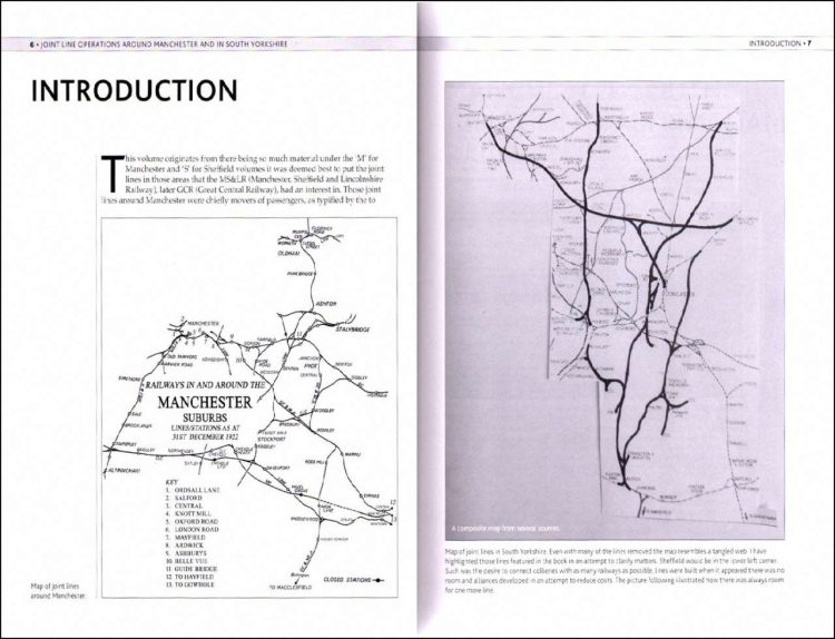
As well as the illustrations there are a large number of maps, but they are of varying standard ranging from superb extracts from Railway Clearing House and Ordnance Survey 25-inch maps to hand-drawn ones. In several instances, the OS 25-inch maps cover too small an area to get an appreciation of the area’s railways. A great many different railway companies operated in the areas covered by the book, and as such through the book there are many abbreviations, such as in the map below which includes “MSJ & A”, “GC & M Jt”, “GC & NS Jt”, “CLC”, “LNW”, and “GC”. A major omission in the book is that it does not include a list of these abbreviations.
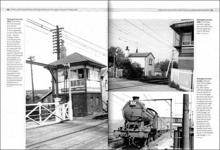
The caption to the photo on the left below twice refers to “the CLR” without any explanation of what the CLR actually is, although the previous page does mention the Cheshire Lines Railway so it can only be assumed that is what the author is referring to. The caption to the photo on the lower right refers to “the man walking on the boards”, but the photo has been so tightly cropped that the man in question cannot be seen in this copy of the page, and is virtually invisible in the printed page in the book.
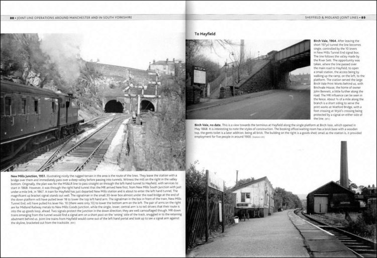
The caption to the photo on the lower right refers to an all-brick gents toilet, but even under a magnifying glass I found it impossible to determine where it is.
There are several instances throughout the book of inconsistencies in spellings of place names. Here we find Moorthorpe & South Kirkby Station at the top left and South Kirkby Colliery at top right, but the loco at centre right is captioned as being at South Kirby colliery, without the second ‘k’ in Kirkby. Elsewhere in the book, the caption to the very first illustration in the book doesn’t make sense as part of it is missing.
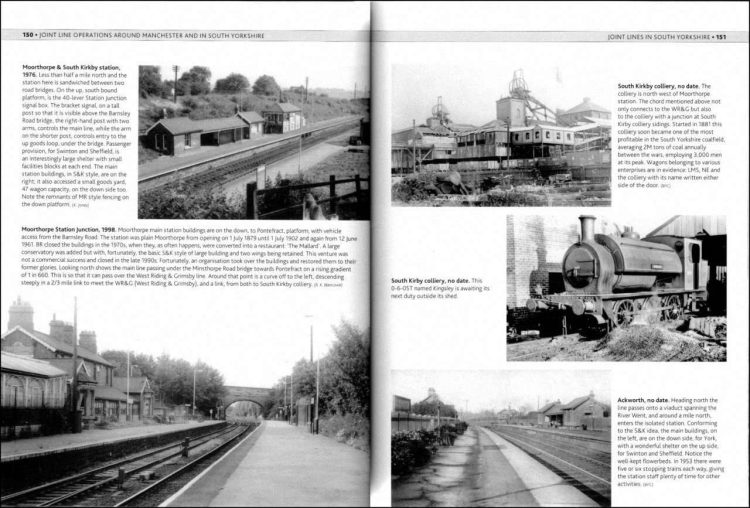
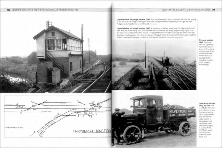
Another non-existent structure is referred to in the caption to the photo at the top left, which refers to “the joint line passing to the left, over the bridge spanning the River Don.” Again, there is no sign in the photo of either the bridge or the line referred to as passing to the left.
In summary, this book, instead of having a narrative, the large number of illustrations are accompanied by extensive captions clearly describing their content. A good range of historic photographs of station buildings and signal boxes add to the very comprehensive coverage. A well-produced work with some very fine images that is sure to appeal to anyone interested in railway history, social history and industry. Some attractive photographs, including Great Central-designed locomotives still at work on passenger and freight trains into the 1950s. Highly recommended.
The book is available to purchase from Amazon and from Pen & Sword.
We would like to thank Pen & Sword for providing RailAdvent with a copy of the book for review.


Responses