The History of the London Underground Map traces the history of London’s iconic ‘Tube’ map, which has been reproduced millions of times on everything from t-shirts and keyrings to duvet covers and is as likely to be found hanging on the wall of a modern art gallery as being carried in the pocket of a London commuter.
Published in August 2022, this hardback book from publishers Pen & Sword and written by Caroline Roope measures around 15.88 cm x 23.5 cm, has 224 pages, and 32 colour and black-and-white illustrations and maps. It has a published price of £20, and at the time of writing Pen & Sword has it available online for £15.00 and it can be purchased from Amazon for £16.12.
In 26 brief chapters, we learn how the development of the map was almost as complex as the transport network it represents. Although brief, the chapters provide for an eminently readable volume with such intriguing titles as “A flirtation with the underworld”, “Things get smutty”, By paying us your pennies”, and “Fares fair in love and war”.
The author describes how producing a map that the public would understand rapidly became a source of frustration and in some cases an obsession. She also describes the wider historical and cultural context as it covers both the people behind the iconic map and the Underground’s artistic and architectural heritage.
It is a remarkable testimony to Harry Beck, who designed the map, that it has withstood the test of time and is a masterpiece of both engineering and design.
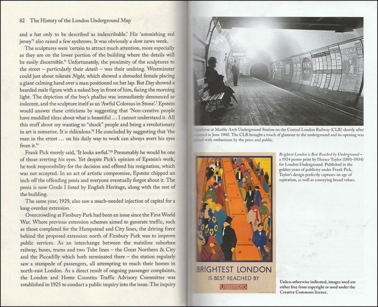
All illustrations are concentrated into 16 pages in the middle of the book. Strangely, the first page of these is not map-related but as seen in the top photo below has a photograph of Marble Arch underground station whilst the lower photo is an early advertising poster.

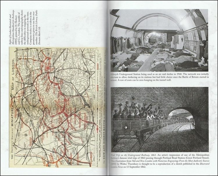
The lack of clarity in early underground maps is clearly shown in the map on the left below, which prominently depicts the District Line in 1883 with its stations marked in bold red type, whilst the District Line’s rival’s stations are in a much smaller and less-prominent typeface. Although the title suggests that the book describes the history of the London Underground map, much of it is devoted to the history of London’s underground system, and the many rivalries that were fought between the different companies. Such history is seen at the top-right below, which shows a photo of Aldwych underground station being used as an air raid shelter during World War II. Dating from 80 years earlier, the lower illustration shows a train on the Metropolitan Railway in 1863.

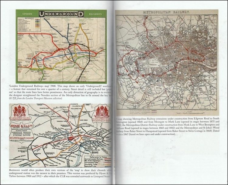
As the book purports to describe the history of the underground map, it would be reasonable to suppose that the evolution of the various maps would be represented in chronological order. That they are not is clear from the maps below, where the one at the top-left dates from 1908 whereas the map following it on the right dates from 1867.

The lack of chronological sequence is seen again below, with a map dating from 1924 on the left and from 1899 at the top-right. The 1924 map makes a great play of how the term “Metro-Land”, which the Metropolitan Railway came up with in 1915, was used in its publicity and which in 1973 John Betjeman narrated a documentary for the BBC based on the phrase.

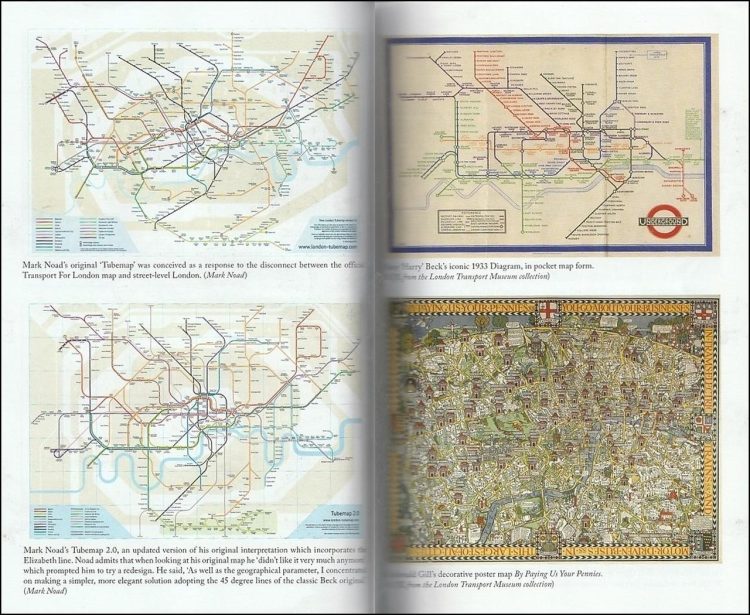
The maps below are a classic example of how not to reinvent the wheel. The maps on the left are unofficial maps produced by a designer, Mark Noad, in 2011 in an attempt to incorporate some sort of geographic interpretation into the well-loved Harry Beck version. Noad’s first attempt was not well received, so he modified it as seen in the lower-left map. At the top-right is Harry Beck’s 1933 map, and although it has fewer lines than on Noad’s maps, the design cannot be faulted for its clarity. That cannot be said for the map at the bottom-right which dates from 1914 and was not designed to be functional but to attract people to visit London.
The book is available to purchase from Amazon and from Pen & Sword.
We would like to thank Pen & Sword for providing RailAdvent with a copy of the book for review.


Responses
While it is a reasonable account of the people behind the development of the London Underground, the title of this book is misleading. Even in the illustrations less than half are maps and two of them are unpublished fantasy designs. There is a book to be written about the Underground map, but this is not it